In the game
Real roads, not a theme park
Every course is built from the place itself, so the climb you ride indoors is the climb you'll meet outside.
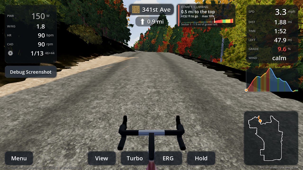

Load any GPX and pedal it on your smart trainer through the real terrain: aerial photos, lidar elevation, the roads' actual surfaces, every climb and every turn. Know where the gravel starts, where the climbs bite and which corner comes next.
Every course is built from the place itself, so the climb you ride indoors is the climb you'll meet outside.
Built by gravel riders who wanted to know what they were getting into.
Import a GPX from Ride with GPS, Strava, Garmin or an event website, or share it straight to Gravel Scout from another app. The route is matched to the real roads and built into a 3D world around you.
Lidar elevation and sub-metre aerial photos in the US and Canada, satellite imagery everywhere else, with mountain ranges standing on the horizon 40 km away.
Paved, gravel, two-track and single track from map data, Ride with GPS and an aerial-photo check, so you know where the gravel sectors are.
Bluetooth smart trainers set the resistance to the gradient, with ERG mode for target power and virtual shifting through your own gearing. Power meters, cadence sensors and heart rate straps connect too.
Every climb, descent and gravel sector listed before you start, with cards on screen as you reach them. Pick your start point from the map and the elevation chart.
Distance to the next turn and an arrow at its real angle, like a bike computer, so you learn the course's corners, not just its climbs.
Built-in sessions or your coach’s .zwo, .erg, .mrc or .fit files, ridden on any course in ERG mode. Adjust the targets as you go; your score for the workout goes with the ride to Strava.
Share a code and ride a course together. See your friends on the road, draft their wheels, and keep the group together if you like.
Upload rides to Strava as virtual rides in one tap, or take the FIT file to Garmin Connect. Past rides keep everything you didn't upload yet.
Real buildings from the map, the trees that are actually there, power lines, fences and road-name signs, so you recognise the town and the corner when you ride it for real.
Live wind at the course pushes you along or holds you back, and you choose the time of day, from early morning to golden hour.
Popular areas download in a few big pieces, and any course can be saved for riding offline. Graphics adapt to your device, from phones to gaming PCs.
There are no fixed maps to choose from. Import the route you want to ride and Gravel Scout builds the course around it on demand, from open map data, lidar and aerial photos.
Export a GPX from Ride with GPS, Strava, Garmin Connect, Komoot or an event website, and import it from your phone or computer.
On a phone or tablet, share a GPX straight to Gravel Scout from the app or email it came in. It lands in your course library, ready to ride.
The first time a route is ridden, its world is built for it: the road match, the surfaces, lidar terrain, aerial photos, trees and towns. Nobody has to have ridden it before.
Imported routes stay in your library with your progress on each, and any of them can be saved for riding offline.
No account to make. Open the app, pick a route and go.
Import a GPX from your phone or computer, or share one to the app. Its course is built for you.
Wake your smart trainer and sensors and they connect over Bluetooth.
Start anywhere along the route, ride the terrain and learn every climb, sector and turn.
Send the ride to Strava, or keep the FIT file for any training app.
Phones and tablets beside the trainer, or the big screen of a PC.
Phones and tablets, Android 9 and newer.
Testing on Google PlayiOS and iPadOS, through TestFlight while in beta.
BetaWindows 10 and 11 PCs, with Bluetooth for your trainer.
BetaUbuntu and Debian, as a .deb package.
BetaWorks with Bluetooth smart trainers (FTMS), power meters, cadence sensors and heart rate straps. No trainer? Preview any course with a flyover.